Wednesday, October 17, 2007

Mountain Views

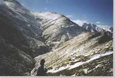
As I have alluded to in prior writings, there are two ways to view the mountains, macro, such as above, and micro, a much smaller and contained view of the mountain world. A wide view is obviously beholden to the weather, cloud and mist commonly swirl about the tops and ridges constantly changing the look of the landscape, or blocking it out entirely. In which case the view is now enclosed, limited to my immediate gaze. Yet limited is a rather poor word to describe what one can see when the eyes are opened to the infinite beauty contained within that small area. This has perhaps been the most hard earned and lingering lesson the mountains have revealed to me. From time to time I could not help but stop and look at something so beautiful as to literally stop me in my tracks. On one of my first crossings with Nigel, a day tramp over the ranges via Maharahara, I recall us gaining altitude in the forest, so much so we were in snow, and coming around a corner on the track where a fallen beech tree was leaning over the track, high enough for us to walk under it. And as we emerged on the other side of it we were stunned by a brilliant burst of sunlight, reflecting itself on the melting water droplets and the greens of the ferns all around. It was magical and alive. We tried to photograph it, but alas, that moment did not translate to film, still, it is alive within me.

Over the first years of my mountain travels the common method was to explore, discover, and move on, never spending more than one night in any particular place. And because schedules were tight we never had time to truly linger and enjoy - not that did not have fun but rather this is just what we did. Over time, and particularly solo, I began to change that approach, out of both necessity and enjoyment. Spending more time in any one place allows more time to enjoy getting there, or at least that is my theory, and I have noticed a learned ability to view my micro world with a vigour and appreciation I continue to develop.

The above photo is a sunset I took on a solo journey to Top Maropea, one of my favourite Ruahine places. I have watched this canvass being painted there 23 sunsets now, though not all I could actually see, and each one is special and unique. This one I had been watching the sun set on the western tops, and just turned at this moment back to the north east and saw this lovely sight. The rounded top is Orupu and the far classic mountain shaped peak is Remutopo, both part of the main Ruahine range, and both climbed over or upon on the high route to Maropea Forks.


Mosses, ferns, and podocarp trees predominate the lowland rain forests of the Ruahines. This particular stretch of forest is near Awatere hut on the Makaretu river, and very unique in its relative flat and easy walking to the hut after the obligatory steep climb and descent over a small saddle. We came across this forest after 6 days of steep climbs and drops, and along with naturally being in tune with our surroundings, I found it somewhat surreal to be walking on such flat ground.


Moving higher up in the forest, above 1100 meters or so, we begin to encounter first the big beech trees, as per below John in the above photo which also indicates how steep the spurs can be, and above this altitude arrives the stunted mountain beech and leatherwood. On a sunny day there are fewer nicer places to rest than on a beech spur after working hard to gain that altitude. The sound of a summer breeze gently stirring the beech leaves is like sweet music. Unfortunately there is, most often, much climbing yet to be done. There are some who say that trees in forests contain their own energy and life force and I am inclined to agree. Stunted beech and leatherwood are tough hearty customers, and dead give aways for the areas prevailing winds. In misty conditions, the high stunted beech forests can take on a very ethereal appearance, one very suited to Aotearoa's Lord of the Rings reputation - see my very first post for a look at what I mean. In particular I find the Parks Peak area to be sublime in this effect. A very long and up and down ridge, with areas of boggy flats, where the micro world, in my opinion, is second to none in the Ruahines, or anywhere. Pictured below is a macro view of Parks Peak ridge, or some of it, as it is possible to walk for over two days to cover its length. This photo was taken from the main Ruahine range just above Totara spur and the headwaters of the Makaroro river looking from west to east.


The second photo is the "backyard" of Parks Peak hut. It took me many visits to actually learn to "see" this area with slightly wizened eyes. It is, in reality, a wondrous garden of a broad array of sub alpine plant life. Someone such as John Muir or William Colenso would have delighted in this little paradise on discovering the place. I, however, am not in their league, so it took me many visits to finally realize what I was amongst. While Muir or Colenso would happily frolic in this wild alpine garden and know what they are looking at, there are very few I personally can identify amongst the myriad of tussock grasses, flowers, mosses and lichen. In the back of the photo can be seen the big round leatherwood bushes - indicating high altitude, as well as stunted beech in back of those. This is one my favourite spots, on a reasonably good day, as they are rare here, to enjoy a Ruahine 'libations hour", and tin cup in hand roam about here and the immediate forest. On my last visit with John, we stood perfectly still and silent in the forest on a misty afternoon. After a few minutes the forest began to settle back into its own rhythms, absorbing us into its flow. The birds resumed their songs, the winds blew over head and sent down breezes and gusts which sent the leaves of the beeches and leatherwood fluttering with their own particular melodies, the moss covered beech branches accompanying them as they rolled and swayed in the wind. I would like to spend an entire day being part of that scene, and I will.

The next two photos are examples of the dripping moss and lichens which occurs in the wetter boggier beech areas. These, again, were taken within minutes of Parks Peak hut. Unfortunately I am only equipped with my inadequate, but useful, digital camera, as the true magnificence and beauty must really be seen in person. It can be clearly seen though, that the mosses have a somewhat translucent quality to them, and I think to spend an evening in this forest during a full moon lit period would be sheer magic, granted it was clear over head. Worth a trip to find out.

The second to last photo are of mountain butter cups in bloom, taken right outside the hut in early January. And the last photo is a close up of a leatherwood bush, also right by the hut. Personally, in the right place and particularly when in bloom, it is a lovely shrub, one perfectly adapted to its harsh environment. In the wrong place, and in its inevitable multitudes, it is the bane of the unwary tramper whom has wandered off a track or is in unmarked terrain. Virtually impossible to walk through, due to its resilient and unyielding nature, I have spent hours making little headway through it, and have found the easiest route, other than avoiding the battle completely, is to simply find an area thick enough with the stuff to just walk on top of it! With my bulk and a pack that would seem no easy task for the poor shrub, but leatherwood is tough and hearty stuff and I present little problem for its weight bearing capabilities.


While there are many areas of the Ruahines I find unique and stunning, the one I find most invigorating to my soul is around water, the rivers, streams, water falls, tarns, and the mysterious Lake Colenso. I do not why this is exactly, perhaps the answer lies in my roots as a Wisconsin native. predominantly farm land once flattened by massive glaciers. My familiarity with water ways was mostly brown muddy rivers, and of course the plethora of great glacial lakes left behind. My experience with clear running streams was limited to the far and few encounters I had with the odd one in the huge coniferous state forests while camping or hunting, and it always stirred something inside of me. To see clear water running over the rocks, to hear the sound of its burbling journey making its way to one or another of these huge lakes, most likely Superior or Michigan, always was a joyous moment. I also enjoyed a fine relationship with the Boundary Waters, the massive, again glacial, area of lakes and streams between Lake Superior, Minnesota, and Canada. Numberless lakes connected by streams or simply carrying one's canoe and gear to the next lake, it was a memorable way for me commune with nature. The ancient granite bones of the earth this country lies upon, and the black glacial lakes instilled in me a sense of awe and humility.

My first foray into the Ruahines was back in 1993, a climb up Gold Crown ridge with John and Nigel. A memorable day in that it taught me the true nature of mountains and how little I knew. It was a hot summer day and after a long steep climb to the ridge we quickly ran out of water and had little hope of finding any at our altitude. Retreating back down, very hot and thirsty, I distinctly recall John and I hearing the sound of rushing water, then seeing from high above a water fall with an amazingly clear pool beneath it. I stood transfixed, both by its beauty and also the potential quenching of my thirst, though we had little hope of climbing down to the stream and carried on still thirsty. My thirst was eventually quenched by an ice cold beer back at the car, but my thirst for these clear mountain rivers and streams still remains thus far unquenchable.

The sound of a river far below, muttering in the distance, is always a good sign after a long tramp, though also indicative of some hard downward slog yet remaining. And when it first comes into view, though no time to yet relax, generally means sanctuary lies not far away. I love the feeling of finally arriving down at a river, sweaty, tired and hot, and slaking my thirst with cold pure fresh mountain water. I have tramped in the Ruahines for almost 15 years now, always drinking straight from the rivers and streams with no ill effects as of yet. Being able to do that staggered my senses back then, and still does to this day. A moment of pure interaction with nature.

The first two photos above were taken on a perfect summer day on the Makaroro river this past year. A day John and I roamed up towards the head waters finding suitable pools to swim in, and there were many, and just enjoying the ambiance of a beautiful mountain river. See the clarity of the water in that second shot, hear it calling it out for you to dive into its chilly embrace!

Next we have a little stream which joins with the east branch of the Maropea river just across from Maropea Forks hut. Notice the slightly opaque tinge to the pool, indicating depth as well as clarity. Gustav and I have, at different times, dove into this pool when it was ice cold in July - winter here in New Zealand. We did not stay in very long. I have seen Blue Ducks land in this pool, and also have seen a trout cruising about looking for a feed before moving on to the bigger pools beyond the forks. The hut is on a fairly long river flat and I have roamed their often as well, just listening to the different sounds made by different parts of the river. From a gentle lullaby on the upper end of the flat, to a faster paced melody further on, and finally the crescendo as it rolls through this small pool , joined by the creek singing its own song in perfect harmony. Sorry for the over the top writing, but I love the sound of the river, everything about it, and this is one of my favourite spots to enjoy the constant symphony of water.

The Ruahines are also inundated with numerous water falls, not surprising given its steep and erosion prone nature. They, again, never fail to stop me from my toil and pause to absorb their energy, each one unique in some way. This particular fall Nigel and I are standing below is on the Pohangina river, located on a creek running into the main river, not far from the headwaters. We could see it from the tops the day prior and on our journey down the river shunned our packs at the confluence of what we thought was the creek running into the river, and climbed up the creek till we could climb no more. What an excellent day!

The last photo is Lake Colenso, which I have written about before in this forum. I love this photo for the remote calmness it portrays, the mist across the lake reminding us of the tempestuous nature of the surroundings, and mostly for the excellent display of the Lancewood tree, the branch with the leaves hanging down just to the rear of the foreground. A unique and gorgeous native Aotearoa tree. A very special place in the Ruahines.


On the Porch at Maropea Forks
The rain patters on the tin roof
Drumming its Song
along with the Endless Symphony
of the river
The Echoes
have called me Often
So I Listen
to the Music again
Alone
Yet Fulfilled
It is Intense
The Fear I felt
in my Solitude was Real
Knowing Your Path is filled
With Potential Woe
Yet I Come to You
I am in Your Bosom
I am Home


Saturday, October 13, 2007

More Huts and Thoughts........

I must preface this continuation of showing the huts of the Ruahines with a thank you to RTC member Nigel Robson for the many photos he has sent to me of huts we have visited. Friendship is another topic I will address at some point, and it can certainly be said that Nigel and I formed the basis of an important friendship, at least writing for myself and in my life, through our discovery of a mutual love of the mountains, amongst other things, and that it was on many a Ruahine journey where a strong bond was cemented. Nigel is pictured above overlooking the Pohangina river and Leon Kingvig hut, already pictured previously. I put this shot in for two reasons, one being I love the photo, and two, it properly captures the true environment, and beauty, the river huts are located in. Most always in a river flat area which is the only possible location for a structure in this rugged country. And as can be seen by how high Nigel is above the river, in a relative short distance above the hut, how steep the country is in the mountain valleys. Descending down to, or climbing up from, any Ruahine river is a daunting prospect.


This is Triangle hut, located at around 800 meters near the headwaters of the Oroua river, between the Whanahuia range and the main Ruahine range beneath Te Hekenga. One of my personal favourite spots on a beautiful river, but also because of the very diverse nature of the walk to arrive at the hut, which involves a western side forest walk to the open tops of the Whanahuias and Rangiwhahia hut, then a stunning open tops walk of 3 hours before the descent to the river. Just an enjoyable tramp to a very cool spot. I have done it 7 times now, and will no doubt be there again. I have seen many Blue Ducks in this area, and heard the call of the even more rare Kiwi bird on a few occasions as well. 3 hours down from this spot is Iron Gates hut, with another 5 hours out to Heritage Lodge and the road end. A great 2 night tramp.


This is Barlow hut on the Makaroro river, 3-4 hours down from Upper Makaroro - though the day this photo above was taken of Taylor and his mate Jake, it took us 7, and we stayed an extra night at the hut. The picture does not do the hut justice, and it has since had a wood room and porch added to it. A large hut, with Maori bunks for 12, and a separate kitchen area on the other side, it is about another 2-3 hours down the river to the road end. As a matter of fact, as the river from here down is wide open and braided, it is possible to get a 4 wheel drive vehicle to within 45 minutes of the hut.


Pourangaki hut sits above the Pourangaki river in some very rugged Ruahine country, between the Whanahuia's to the south, and the Hikurangi's to the north. Waterfall hut is accessible via the tops from this point. Coming down from the Whanahuia's to here involves one of the steepest drops down a spur that I know of in the Ruahines, and equally daunting going back up! A very cool spot located on perhaps the only flat area around in a little hollow with a wide open "back yard", and an excellent spot to sit in and listen to the bountiful bird life and river muttering far below. I have been here twice,the first time being on my own and an amazing solo experience, and again with John where we stayed here two nights doing a day trip up to the Hikurangi tops on one day and exploring the lovely Pourangaki river. A long way to get here from any direction and mostly used by hunters,


Taylor pictured at Sunrise hut, the most visited hut in the Ruahines. A veritable highway to get here, compared to just beyond the hut, it is still a steep 2 hour walk to here, but offers quick access to the waiting interior. Top Maropea is an hour away via Armstrong saddle. Very few make the trip beyond the safety of Sunrise. Since this photo the hut has again been enlarged to sleep 24 and another kitchen room added. With gas cookers and gas heater not really my cup of tea in terms of a true mountain experience, yet I have stayed here a number of times. Some because of weather, gale force winds, preventing me from crossing the saddle, and a number of times walking up late in the afternoon or at night so as to get an early start in the morning. Aptly named Sunrise, on a clear morning, for its stunning view of the sun rising in the east over Hawkes Bay and the ocean.

Both photos above are of Longview hut on the main Ruahine range. A three hour walk up from the road end. We, John, Nigel, and myself, arrived from Daphne hut after a thwarted attempt at Sawtooth ridge. A pretty stunning location, hence the name, it sits not far from Pohangina saddle and the very headwaters of the Pohangina. It sleeps 15 and has a gas heater, but the location makes up for the lack of true back country ambiance in terms of accommodation.


John, Nigel, and Robb at Top Gorge hut. Perhaps one the most remote and least visited huts in the Ruahines. The hut book when we visited in 2003 went back to the 1980's and was still far from full. This hut is scheduled for removal in the next 10 years, or will simply be left to deteriorate. It is only a rough two bunk shelter, with an open fire, but a very cool spot. The day this photo was taken brings back many memories of a superior day, we climbed down from Longview and traversed the Pohangina from its source to the hut on an exceptionally fine day - in all ways. Notice the boots and socks drying in the sun on the wood shelter, a dead give away of a river walk! This hut is hard to get to, and I cannot honestly say I will return here again, though should I do a complete traverse of the valley I will. Even when this hut is gone, or not worth staying in, it is still an excellent camp site. What I recall most about the hut book was reading of 4 generations of the same family who often hunt in this area, and with great success. As I have said I find the Pohangina valley to be a very spiritual place, with many finding a strange, yet compelling, connection to it.


Above is Mid Pohangina hut. The last hut on the Pohangina river, 2-3 hours down from Ngamoko, and 5 hours out to the road end. The Pohangina by this point is a fairly substantial river, big pools and good swimming! Not to mention ample trout as well. A six bunk hut with an open fire. I have been here twice, once with Nigel, and once I stopped here en route from Ngamoko after an enforced weather stay there. As the weather had not improved and I was overdue I decided to come out via the river so as to alert Tara. I stopped here to dry out a bit and fire up the billy. No sooner had I left the hut when I heard a helicopter coming down river from Ngamoko looking for me! I was a bit flabbergasted but took up their offer of a ride back to my car, saving me quite a bit of hassle as coming out the river would have left me a long ways from my vehicle. It was a fantastic perspective from which to view the Ruahines, though a bit deflating to arrive back at my car in 15 minutes from a spot it had taken me 4 days to walk.


Iron Bark hut is located on the Whakaurekou river, which is the confluence of the Maropea, Waikamaka, and Mangatera rivers as they roll out of the ranges. Beneath the Mokai Patea and about 3 hours or so from Lake Colenso it is mostly visited by hunters helicoptered into the hut.

I have been here once, but Nigel has been here, I believe, on 3 separate occasions and the hut has been virtually rebuilt from the above photo.


No one gets to Lake Colenso hut, above, unless in a helicopter, with out earning the right to put one's feet on it's lovely porch. The day I arrived with John and Nigel from Maropea Forks was another long and memorable day. The hut sits not on the lake, but rather the Mangatera river, or a branch of it anyway, as this area is really a natural bowl with various streams and creeks all draining into the Mangatera or being held in Lake Colenso, a very unique area. The lake itself is about a 15 minute walk from the hut and down to the lake. Surrounded by bluffs it is a remote and mysterious place. The hut is just a lovely spot and just reward for the effort expended to get to it. If I ever do get back to it, you may rest assured I will be spending more than one night in it's charms.


Around 4 hours along a ridge of the main range and descent to and up the Tuki Tuki river is Daphne hut. A big spacious hut, sleeping 15 Maori bunk style, with a grunty Fat Boy wood stove and plenty of bench space for billy boils and cooking, a popular destination for tramping club large groups and other bigger parties. Though I have encountered no soul at all in my 3 visits there. Just across the river is Daphne spur, an extremely steep route up to the main range and Howlett's hut, noted previously. I was here with Taylor when he was fairly little, and with Nigel and John on our epic 6 night adventure. However the most memorable trip was with John, when we went on a winter trip to scout out the routes for the summer trip with Nigel. We arrived at Daphne in fine sunny weather, but when sitting out by the river enjoying the evenings libations it began to rain and got very cold. No problem with fire master John and the Fat Boy. We awoke to discover over night the rain had turned to snow, and we were amongst a winter wonderland. The walk up that day to Howlett's hut and the ensuing beautiful day spent up there frolicking amongst the Himalayan looking snow covered peaks was a very much spiritual type experience for me. And the next day, on more fresh snow, we literally "skied" down to the forest and made it back down to Daphne in less than an hour.


I remember arriving at this hut above, Otukota hut, with Gustav in July 2000. We came over from Maropea Forks via Puketaramea ridge and the drop down to a very high Whakaurekou river, and crossed to climb up to the hut. We were a bit disappointed in the hut, 6 bunks, open fire, very tidy, simply because we had come from Maropea Forks and its special charm and allure. Yet by the end of that night I appreciated this place for its own special ambiance. By the light of Gustav's hard earned fire it looked cozy and welcoming to our tired Souls. And to compare Maropea Forks to anyplace, particularly after our struggles to get there, was just blatantly unfair. Somewhere in my mind then was planted a seed that eventually sprouted saying to me all these places are special and unique and I am simply lucky and blessed to have been put in a position to discover the mountains. It occurred to me that to get these precious gems is such hard work, why just pack up and leave such a spot after only, really, a few hours. It impacted my entire philosophy of mountain travel, especially as I grow older, and the aches and pains of age begin to emerge. Stay! Enjoy! You have Earned This!! So I do, and I will.


I cannot say I will return here, unless I come down, and go back via the Maropea river to Maropea Forks, or the the ridge. But to go out via Mokai Patea is a long, and now dangerous walk, as huge slips have wiped out portions of the anyway brutal track out of the steep forest to the Mokai. It was hard enough when Gustav and I did it. Writing this though, thinking it would be cool to come down from the forks, spend a night and go back to the forks, would be an interesting way to expand our horizons. I wonder what John thinks?????????????????????????


Finally, we have Waikamaka hut, pictured above. Just above the headwaters of the Waikamaka river and some brutal country heading up to the main range and Waterfall hut. John and I came up river from Wakelings hut, spending a night camped on the river due to an impassable gorge - at least then because of high water which dropped over night, allowing us to carry on to the hut. We dropped some gear here and carried on to Waterfall, returning here the next day in a huge deluge which got all the water courses raging. John and I literally witnessed a river born high on the tops turn from a gentle little brook into a muddy torrent within minutes. A very humbling experience. John and I spent an excellent afternoon listening to the rain pound on the tin roof, the wood stove cranked under John's expert tutelage, talking, firing up the billy, reading old Reader's Digests, napping, and enjoying our last day in these special mountains. Later, as the sun began to set, the rain stopped and we went outside, tin cups in hand, to watch the muddy river now, literally again, clearing and dropping before our eyes as the fading light painted the tussock tops in purple and golden hues.


This is another hut actually owned by the Heretaunga Tramping Club. So the HTC maintain it, again for a bit of Koha, and I distinctly recall member Nash sending them a cheque for 50 bucks, so the RTC is in good graces. Again, Maori bunks for 12, excellent wood fire stove, with bags of coal stocked by the club, and far enough away from any where to make it a crowded destination. The most straight forward route would be right up the Waipawa valley and over Waipawa saddle and drop down to the stream which is followed to the hut. Or over Te Atua Para Para, via Armstrong saddle and then to the stream. Either way the drop to the stream is not for the faint hearted, as it follows an ever eroding narrow tussock mini spur from the saddle to the creek. Best to not look down!!

Thus ends this portion of the huts of the Ruahines. No doubt I will update the hut page from time to time, as there are many huts I have visited and have no photos available, and new ones to visit. Gold Creek, Sparrowhawk biv, Kylie biv, Awatere, Iron Gates, and Wakelings are the ones which I must find photos of, or return to, which jump to mind. No matter, these are all VERY COOL spots. Some which I will return to many times, for my own personal reasons, some perhaps not. I must choose my Ruahine destinations wisely as time possibly grows short in terms of physical and mental ability to deal with Her ever changing Nature. No matter what I shall consider each Journey there a True Blessing and appreciate it for each second.

The following poem was written in 1962, by a deer culler working in the Kaweka range, separated from the Ruahines only by the Taruarau river, and I believe totally sums up the feeling of seeing a hut come into view. When I first came to the mountains I disdained huts, in my know it all American superiority favouring camp sites and tents. I knew little of the volatile nature of southern hemisphere mountains. I have learned to love each hut as its own special sanctuary.


"Kiwi Saddle Hut"

This here shack might be about the roughest

In the whole of the Kaweka range

Strictly designed only for the toughest

The architecture is rugged and strange


Obviously built by someone desperate

For shelter away from the storm
With facilities only barely adequate

And cuisine of a curious form

The plumbing is a little faulty

There's little chance of too much ventilation

Chances of service are definitely slim

And the wall linings need renovation

But when I come here staggering over your ridge

Exhausted and half dehydrated

This hut looks to me like a publicans fridge

And my belly will soon be inflated

Written by Harvey McCullough, Kiwi Saddle hut book 1962. * Note, a Publican in New Zealand is the same in the states as a bar tender, or bar owner, the serving of beer, as it were.

Well so what, ol' Harvey was no Wordsworth, but then again, Wordsworth was no deer culler. So who is the better man?


Tuesday, October 9, 2007

Huts in the Ruahines


Those who love mountain travel in New Zealand are blessed not only by the large number of mountain ranges, National and State Parks, both in the North and South Islands, from which to act upon our chosen pursuits, but also by the large number of huts within those areas to take shelter in, or to just enjoy the relative luxury of a hut compared to a tent in weather tempermental areas. By luxury I mean catering to the basic and simplistic needs one requires, a tin roof and walls, between 4 and 6 bunks, as a general rule, which vary greatly in degrees of comfort, either an open fire or a firebox for heat, and if high up on the tops, a water tank capturing water from the roof, or if by a river one simply gets water from it. There are higher use huts located within a few hours of road ends which are larger, 12 -30 bunks, which also have gas heating and cookers, and in many of the higher use parks and ranges these would be the norm. The Ruahines, however, are not a high use area, only two huts, Sunrise, and Rangiwahia, are in the class of the latter hut description, both being 2-3 hours from their respective road ends and fairly often used by school groups and other larger parties. Almost every other hut inside the interior of the park, if not all of them, are the very basic shelters I have described. Yet each has its own flavour and character, most located in sublime spots, either close to or on a river, or high up on the ranges or ridges. Most were not put in the beautiful spots they are in for aesthetic reasons, but rather the rugged nature of the mountains dictating the only possible places for them to be built.

The Ruahine huts were originally built as places for men to stay in who were part of government efforts to control exploding deer populations. Deer were an introduced animal to Aotearoa, and with no natural predators to keep herds in check, they flourished in the mountains and soon grew into huge herds, destroying the forest undergrowth, enhancing natural erosion, and seriously altering the natural balance of the forest. Thus, these men, or deer cullers, were sent into the oceans of New Zealand mountains and forests for months on end, to kill as many deer as possible. They lived, at first, in tent camps, set up at various places so as to cover their huge territories, and eventually as a system of tracks grew, huts were put in to make their meagre existence more "comfortable". These were hard men and this chapter in the mountains history an interesting and colourful one. These huts and tracks are now left to those who travel in the mountains, and kept up and maintained by the Department of Conservation, who charge a small fee for the use of them. The Ruahines have over 60 huts interspersed along its open tops, ridges, and rivers, indicating the rugged nature of the country - the cullers always wanted a safe refuge within reasonable reach in the volatile mountains. I have personally been to over 40 now, some I revisit often, others only once, but one thing they have in common is that I have been damn glad to see them all come into view after a hard slog to get there! So I thought I would share some photos of some of the huts I have visited and a few thoughts about them. This will be an ongoing post, as many of the huts I have visited I do not have postable photos of, and, of course, there are always new ones to be added!

The first photo above is Top Maropea, overlooking the Maropea valley, and one of my personal favourite Ruahine spots. I have spent 23 nights at Top Maropea, sometimes in passing through, sometimes as a destination on its own. It was built in the mid 1950's as culler hut and is still the original structure, and now an historical sight. Though it is only 3-4 hours from the road end, and an hour from Sunrise over Armstrong saddle, it is relatively rarely visited. A lovely place at 1242 metres, on a nice day simply stunning, on the more often windy, rainy or snowy day, still cool. I have had to stay here twice longer than expected because of bad weather. Being as it offers both a special connection for me personally, and a route deeper into the wonderful interior it will not be too long till I return here once again.


About 4 hours below Top Maropea, via the river, is the above hut pictured, Maropea Forks, which is, simply put, the overwhelming favourite Ruahine spot of most RTC members, and certainly mine. Located in a truly sublime spot, just above the confluence of the east and west branches of the Maropea river, hence Maropea Forks, and situated perfectly to the path of the sun moving across the valley, if you are lucky, it is just a wonderful place to be. Pretty much in the heart of the Ruahines, or at least on a veritable highway of tramping options, I have arrived via the river, over the tops, and left in every direction. It has also become just a favoured spot on its own, either on my own or in the company of others. One I have stayed at up to 3 days simply enjoying its beauty.

It is a 6 bunk hut, with a Corker wood stove, ample room inside for ones gear, and as one can see, has a roofed in porch to while away the hours should it be raining. The river runs close by, as a matter of fact it has dramatically changed course and is now cutting severely into the very bank the hut is sited upon. This will be a major concern should it continue. Again, built as a culler hut, the current structure was rebuilt in the 1980's and was recently refurbished again from the above photo. Many of the old cullers who worked out of here have written of this place and a special appreciation they hold for this area. They are not wrong.

I have made 13 trips to this hut, the first were merely passing through on crossings for a night, yet it made such an impression on me I began to return again and again, and will continue to do so. The walk down from Top Maropea would be one of the finest mountain river walks in the world.


Another area in the Ruahines which has become a personal favourite is the Makaroro valley and Parks Peak ridge. Offering excellent access to the main Ruahine range, and multiple tramping options, or, again, as a destination in itself. Above is Parks Peak hut, situated high on Parks Peak ridge, around 1300 meters, in a very unique and mysterious stunted beech forest. It is a long tough climb and walk to this hut, commonly taking me anywhere from 5-7 hours. And while the hut itself is fairly unimposing and basic, 4 bunks with a temperamental Corker, in an often boggy and wet location, it has also become a personal favourite. Perhaps because seeing it come into view is always such a relief, but more so it is such an amazing place both micro and macro, with awesome views across the ridge to the main range, and yet often misty and closed in revealing the tussock grasses, mountain flowers, leatherwood, and incredibly stunning looking dripping mosses on the stunted beech. One of my favourite spots to wander tin cup in hand.

This is a classic example of the first deer culler huts built in the 50's. Basic and simple, meant to provide shelter. It has for me 8 times now, and will again. Also located on the cusp of other great tramping routes, particularly the sublime Upper Makaroro a few hours away.


This is Upper Makaroro hut, a few steep hours down a spur off Parks Peak ridge and across the Makaroro river. Another two hour equally steep climb up will bring one to the main Ruahine range, or 3-4 hours downriver is Barlow hut. I have had some beautiful summer days here, the river is full of crystal clear pools for swimming, and also trout. It took me 3 attempts to finally get to this hut, and I have now been there 4 times. Very short days in winter as the valley is very narrow and the sun moves over it quickly, but the hut, although the basic Forest Service design, is comfortable and has a great wood stove with ample wood available at this altitude, 800 meters or so. Another favoured river spot, and not often visited.


Above is Waterfall hut, an extremely remote location in the Kawhatau headwaters, and a long way to get to from any direction, any of which is tough and challenging. It is at least a two day walk to get to this hut, which lies on the confluence of Waterfall creek and the Kawhatau river up on a natural terrace above a unique horse shoe bend in the creek. A very wild and stunning location underneath Mangaweka and the Hikurangi's to the west, and the main Ruahine range to the east. Mangaweka is the highest point in the Ruahines at 1733 meters, and this hut is in some of the most rugged Ruahine terrain. I have been here twice with John, once coming over from the eastern side and Waikamaka, and once coming directly down from Mangaweka. A basic 6 bunk hut with a fireplace. Always glad to be here.


Five hours or so down the Kawhatau river from Waterfall hut lies this little gem, Crow hut. A few years ago John and I walked a few hours down from Waterfall, then camped on the river, and carried onto Crow the next day. The Kawhatau is a bigger river and comes up quite quickly, and with two nasty gorges to negotiate it pays to keep an eye on the weather. Notice the swing bridge is high over the river, this is for a reason! Crow hut is also 6 bunks and recently been refurbished, new walls and lining, fireplace replaced with a new wood stove, all good. The hut, as one can see, sits above the river with ample room to pitch a tent or just lounge away, and the river below offers excellent swimming and trout fishing. I have been here 3 times, once with RTC members Steve and Rick, once on my own, and once with John. An exceptionally cool spot with excellent views of Rongotea on the Mokai Patea's, the Hikurangi's to the south, and once again, the main Ruahine range to the east. An amazing place to watch the sun set on the eastern tops, the colours which emerge never fail to stir my very soul. With ample wood about I am keen to return here for a winter tramp.


High above Crow hut, and to the west, on the Hikurangi's, is Mc Kinnon hut pictured above. Perhaps the finest upper alpine located hut in the entire Ruahines. Fantastic views in every direction, the Kawhatau valley far below, and the Mokai Patea across the valley, and the main range literally across the way from the hut door. I believe this is the highest hut in the Ruahines at over 1400 meters, just slightly higher altitude than Howlett's hut. A long day to get here over the Hikurangi's but a stunning walk through rolling tussock and tarns, ( natural depressions in the tussock which collect water), one actually the size of a small lake. Just when one reaches a main turn in the Hikurangi range to the south, there is a near vertical long drop to the hut, which can be seen high above, but still seems to take ages to get to it. From here it is 4 hours or so to to the Ruahines highest point, and another 2-3 hours to get down to Waterfall hut. Or one can drop down to the river and find Crow hut in a short 2 hour jaunt. I have been here twice, once solo, and once with John. Again would like to spend some time in winter here, with a comfy 6 bunk hut and stove, combined with the astounding views, how could I go wrong?


Howlett's hut, on the main range. Perhaps an even more dramatic setting than Mc Kinnon, due to its proximity to the main range, and the view out onto the east coast of the North Island. A larger hut, with room for up to 15 on platform, or Maori bunks, and a coal burner. This hut is actually owned and maintained by the Heretaunga Tramping Club, who require a bit of koha, or donation, for its use. Situated just off where Daphne spur meets the main range above 1300 meters, it is a dauntingly steep 2 hour climb from Daphne hut on the Tuki Tuki river.

The hut has a long history in the Ruahines, originally built in the 1930's with hut material carried up on the backs of the original HTC members, and the hut contains many of the old hut books copied and left to be read, along with some amazing photos.

It is also the gateway to Sawtooth ridge, which lies just to the north, an hour or two beyond the hut and accessed via Tiraha. I have been here twice, once with John in winter when this photo was taken, and once with Nigel and John waiting for the weather to clear so we could get to Sawtooth. It didn't and we retreated back to Daphne. I will return again.


One of the more interesting valleys in the Ruahines, to me, is Pohangina valley. I have spent a bit of time exploring it, with Nigel and John, and mostly on my own. I find it to be a very haunting place, and I do not mean that in a scary or fearful sense, rather, to me, in a spiritual sort of way, that I am not the first, nor last, to feel the connection between man and Nature in this place. The valley has 4 huts situated in it, I have visited them all, Top Gorge, pictured above is Leon Kinvig, Ngamoko, and Mid Pohangina. To do a proper trip either up or down the valley would take 3 days.
Leon Kinvig, above, is the second hut on the river coming down from its source. Named after a deer culler who drowned in the 1950's - perhaps part of the reason for never actually feeling alone in this valley, it is another sublime location on the river. It has Maori bunks for 6, and an open fire, a roofed in porch, and is another relatively rarely visited hut. My last trip there a few years ago I was only the 8th party through in more than a year. I was also there with Nigel in 1998 on the very first overnight RTC crossing, when we came over from the eastern side on a very long and hard tramp. It is equally hard, if not more so, from the western side as it involves another long and steep climb up to the Ngamoko range, and then a long meandering, but enjoyable, stroll along the tops before the normal steep drop to the river. Coming up river, or down would involve a few days as well, so it is not often visited. Yet, for those who do take the time the rewards are many, and the hut book is full of return visits from ex cullers coming to take a last look at a place they obviously were impacted by greatly. It is a hut I look forward to returning to one day.


Approximately 3 hours down river from Leon Kingvig is Ngamoko hut, pictured above. It had just had extensive renovations done when I came across it in November 2005, and I was the first tramper to enjoy its relative luxurious amenities. 6 bunks and a new wood stove, new walls, floor and tables, I happily ensconced myself. Which proved a good thing, as the next day trying to get out via the tops I was forced back here by high winds and white out conditions, and had to spend an extra night.
The hut sits high above the river and is 2-3 hours upstream from Mid Pohangina, then another 5 hours from there to the road end. Again, not a high use hut, I was the 9th party in a year to visit, and only the 4th that tramped to it. The rest were hunting parties helicoptered in, and the work parties who rebuilt it, also helicoptered in. I will return again to do an entire traverse of the valley, taking my time. I sat out in front of the hut down by the river when there by myself and a Blue Duck flew by, then he turned around and flew back, landing 20 meters away from me and jumped up on a rock in the river, seemingly as inquisitive about me as I was about him. A cool moment.
I will, as I wrote, update this entry as more photos become available, which might be boring to some, but so be it. It is a cool way to track the huts visited, and also to remember them. Not to mention it is probably me who is the only one to read this anyway. Ka ki te!

Sunday, October 7, 2007

Your Boots Never Do Quite Dry


One of the most memorable, though all my Ruahine tramps are memorable for one reason or other, was a trip with members Parduhn and Davidson, back in December of 2001. Not just for the fine company in a period where my mountain experience and skill was still being honed, but rather for the wild and wet weather we experienced for fifty six continuous hours. As we crossed Armstrong saddle on the way to Top Maropea it suddenly became very still and grey as a huge slow moving south easterly system engulfed the ranges. It started raining not long after we got to Top Maropea and literally did not stop for over 2 plus days late in the afternoon at Wakelings hut. In the interim we battled flooded rivers, wet and rain soaked forests which drenched us as we walked and climbed and descended through the murky mist. It was a true back country mountain trip done the hard way. Yet Steve and Rick both came through in good cheer and got a real adult portion of the Ruahines.
Above is a photo of the Maropea in flood on our way down from Top Maropea. It started out a bit discoloured when we got to it, and within an hour was the raging torrent above. Yet we were also too far down to turn back, and had a reasonable distance yet to go. So we kept moving very carefully down to Maropea Forks. Had we made the seemingly prudent decision to stop and wait, we would have been there for two days. Fortunately, having been down the river 3 times at that stage, 13 now, I felt I knew the river well enough to get us through. The Maropea is generally not a deep river, with only a few areas of deep pools and rapids, and so we made it down. Usually this stretch would be a quiet crystal clear mountain setting. Had I been with Taylor, or alone, and not known the river, I would not have attempted to traverse down to Maropea Forks.


Inside Maropea Forks hut, preparing a large and bountiful feast of Hopple Popple for the boys after gratefully arriving at the hut, wet, tired, cold, and very hungry. If I recall, this batch had 8 eggs, 4 large potatoes, onion, garlic, 6 rashers of bacon, and generous dollops of salt, pepper, thyme, a dash of chili, and cheese. We ate the lot, easily.
Steve and Robb on the spur between the Waikamaka and Maropea valleys. Sitting in the rain in a little hollow filled with ferns, a lovely place. Not typical of the up and down nature of the spur, and of course, the extremely steep drop to the Waikamaka river which awaits us.

Steve crossing the Waikamaka river, a bigger river in general than the Maropea, but still quite discolored as one can clearly see. The rain finally started to let up a bit that afternoon at Wakelings hut, where we fortified ourselves with a good fire, reading the writings of Mike Mc Gee in the hut book, and a few generous drams of Jameson's Irish whiskey.

Rick and Robb crossing the Kawhatau river, our third swollen river to be dealt with, and a huge climb out of Wakelings, over Rongotea, then down again to this river and Crow hut. We discovered two cans of Tui beer at the trig on top of Rongotea just as the sun appeared for the first time in over 3 days, so we drank them down and toasted the Ruahine Goddess. Only to have the clouds immediately roll back in with the wind and we got lost trying to find the route down to the river. It took us a fair while to sort ourselves out, but eventually Steve noticed a rudimentary track down through the tussock and the diabolical maze of razor sharp Spainards which got us back in the game. We are crossing the river at the confluence of the stream coming into the main river, then crossed the stream to a "wet weather" track just above the photo. Not that we couldn't get any wetter than we were anyway, but it leads to very long swing bridge high over the river, and on the other side, the beautiful sight of Crow hut.


RTC Members Kloss, Parduhn, and Davidson, at the finish line. Don't believe those times on the sign! Took us a bit longer than 3 hours from Crow hut over the Hikurangis. Tara met us near here with cold beers, a Ruahine Goddess in her own right!